Desktop Mapmakers
By Karen Berger
Photographs By John R. Fulton Jr. and Olivia Ogren-Hrejsa
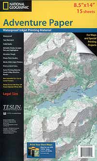 1. National Geographic's Adventure Paper |
Gone are the days of tracking down government-printed topographical maps for a wilderness trek. Today you can find, customize, and print your own maps from a variety of software manufacturers.
Technology is changing how we find our way through the great outdoors. A big part of trip planning used to be finding (and buying) the right maps. Because the United States Geological Survey (USGS) publishes 58,000 maps covering the entire nation, planning a long trip to a remote location could be a cumbersome logistical challenge.
No more: Today, a map of any wilderness area in the country can be a mere mouse click away. Thanks to computer mapping software, the entire USGS topographic library is available on disk, at a reasonable price, especially when compared to buying individual maps.
In some cases, you can transfer some of the map software information (such as waypoints) from your computer directly into a PalmPilot or similar device or a global-positioning system (GPS) unit. Or you can use it the old-fashioned way: Select only the portion of the map you need and print it out. For printing waterproof and durable maps on inkjet printers, try 1. National Geographic's Adventure Paper ($19.95 per 15-sheet pack). www.ngmapstore.com.
The major electronic mapmakers have a lot in common, but there are some important differences among the four companies that follow. The user-friendly Maptech is based on classic, unedited USGS quadrangles. DeLorme offers good maps at a bargain price. National Geographic provides beautiful maps with impressive 3-D and flyover views, and the Internet's Trails.com has simpler operations but offers online maps and guidebooks for the entire United States.
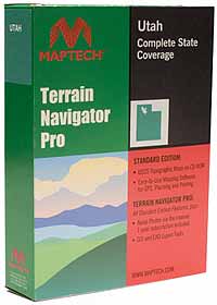 2. Maptech Terrain Navigator Standard Edition |
Sold separately by state (and, in the case of the smaller Eastern states, by region), each Maptech package includes several disks containing the USGS topo maps for that state or area. Each CD has both 7.5-minute and 15-minute maps (1:24,000, for more detail; and 1:100,000, for less).
Maptech's packages of trail maps for the Continental Divide, the Pacific Crest, and the national parks are bargain-priced at $49.95 each. The only disadvantage is that Maptech's maps are only as up to date as the USGS makes them, so some information may be out of date.
The company's Terrain Navigator Pro Edition ($299.95 per state or region) offers aerial photos and a one-year subscription that allows you to download new photos from Maptech's Web site. For most, however, the standard package will more than meet their needs. www.maptech.com.
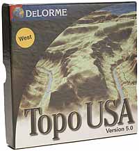 3. DeLorme Topo USA |
But the software, which froze or crashed several times in multiple test sessions, can be difficult to use. It also has a bit of a steep learning curve: Some of the controls, such as zooming in and out and moving up and down the map, are clunky and not easy to master. With a little patience, however, you'll be able to manage waypoints, 3-D viewing, profile mapping, searching by place name, and route tracking.
The maps come in a convenient package (for instance, one disk contains all the maps for California) and offer great clarity and many different zoom lengths. The CDs are divided into eastern and western regions, and the bargain price gets you all the topos for half of the United States! www.delorme.com.
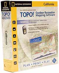 4. National Geographic TOPO! |
Once loaded, the software includes some important and useful features.
First, National Geographic uses both USGS topos and its own maps and offers a live map update feature, so the maps are as up to date as possible. The 3-D views are superb and give a real feeling of being on the terrain.
The draw-your-own-route feature is also a cut above the rest: You can mark a squiggly line, and the software will calculate the exact distance as well as give information about waypoints and elevation. It even shows you what an aerial view of your route looks like. You can add your own notes, symbols, and photos. Available in state and regional packages. www.nationalgeographic.com/topo.
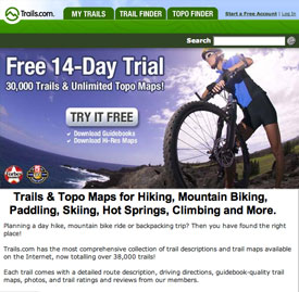 Trails.com ($49.95, annually; free 14-
day trial membership)—The Internet-based site Trails.com can be a bargain because the annual fee provides unlimited topos and information on more than 30,000 trails nationwide.
However, you need a high-speed Internet connection for the graphics to load at a reasonable speed, and
the print quality isn't as clean as the CD-ROM-generated maps.
Trails.com ($49.95, annually; free 14-
day trial membership)—The Internet-based site Trails.com can be a bargain because the annual fee provides unlimited topos and information on more than 30,000 trails nationwide.
However, you need a high-speed Internet connection for the graphics to load at a reasonable speed, and
the print quality isn't as clean as the CD-ROM-generated maps.
Compared to the CD-based software, Trails.com also falls short when it comes to map tools such as profiling elevation, route marking, waypoint tools, and 3-D viewing.
Where the Web site excels, however, is in the sheer amount of information: In addition to the maps, Trails. com offers up to 50 free trail guides (more available at 99 cents each), real-time weather data, trail town facts, news on outdoor activities, and aerial photos. www.trails.com.
Karen Berger is the author of Backpacking and Hiking (DK Publishing Inc., 2005). Visit her at www.hikerwriter.com.
January - February 2007 Table of Contents
Copyright © 2007 by the Boy Scouts of America. All rights thereunder reserved; anything appearing in Scouting magazine or on its Web site may not be reprinted either wholly or in part without written permission. Because of freedom given authors, opinions may not reflect official concurrence.