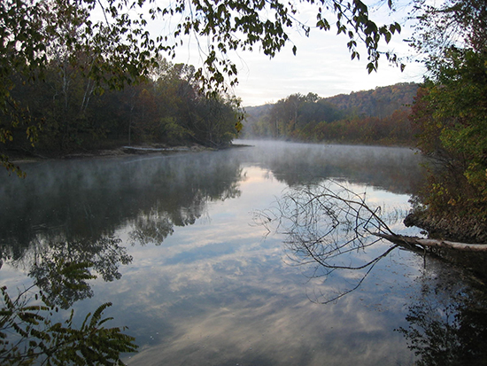
Explore a Missouri paddling paradise at the Ozark National Scenic Riverways
LEGENDARY AMONG CANOEISTS for laid-back float trips, the Ozark National Scenic Riverways of south-central Missouri — the first national park area to protect a river system — consists of 100 miles of the free-flowing Current River and 34 miles of its main tributary, the Jacks Fork. Together, these two rivers — along with the adjacent buffer-zone land — form one of America’s most splendid waterways. In 126 square miles of land, you’ve got heavily timbered hills and “hollers”; isolated canyonlike “shut-ins”; hundreds of exceptional caves and freshwater springs; towering limestone bluffs, trails and historic sites; and clean, shady gravel bars dishing out Ozarks camping at its finest.
Paddling Details: Sufficient accesses allow canoe (or kayak) trips of just about any duration, from a half-day outing to a tour of a week or more. The Upper Current section between Baptist Camp and Two Rivers is a beautiful stretch of river. The 51.5-mile voyage generally takes three to four days, though with several intermittent launch points available, shorter trips are possible. Many believe that the Scenic Riverways is at its wildest on the Jacks Fork. A float trip here is highlighted by cold springs, clear water, mysterious caves, massive cliffs and a more “creeky” feel. Some canoeing experience is helpful when navigating these rivers, but novice paddlers should have little difficulty, especially on the gentle Current. However, a few sections of the Jacks Fork are narrow and winding, which might require more boat-handling ability.
Backpacking Details: For those who prefer to hike rather than paddle, there’s the Ozark Trail, a planned 500-mile route from St. Louis to Arkansas. A completed 30-mile section of the trail, which some believe is the most scenic trail in Missouri, hugs the Current River near Owls Bend before heading south to Route 60. Among its attractions are hills and knobs, valleys filled with springs, crystal-clear streams, and shut-ins and waterfalls. Glades atop Stegall Mountain allow expansive and unrestricted views of the Ozark landscape. Detailed maps of each Ozark Trail section can be downloaded from the Ozark Trail Association website, ozarktrail.com.
Camping Details: Camping within the Riverways is allowed at designated sites within developed campgrounds, at primitive float camps or on the frequent gravel bars alongside the rivers. Along the Ozark Trail, your campsite must be at least 100 feet from the trail or any developed or scenic area. No permits or fees are required for primitive camping.
Of Interest: Both rivers abound with clear deep-green pools, perfect for lazily casting a line with the hopes of catching smallmouth bass, rock bass, carp, sunfish and even trout near the cold springs.
When to Go: Summer weekends are hectic; avoid them unless you’re interested in a paddling party. Instead, choose spring or fall, summer weekdays or, if you really want solitude, wait until winter. April or May is usually best because of the cooler weather and flowers in bloom.
Did You Know? One of the world’s largest concentrations of springs is found in the Missouri Ozarks. A few miles south of the Highway 60 bridge at Van Buren (where park headquarters is located) is Big Spring, the granddaddy of Ozark gushers. One of the two largest single-orifice springs on the continent, Big Spring discharges some 278 million gallons of cool water per day into the river, enough to supply the needs of several midsize cities. A short hike from the parking lot leads you there. Adjacent to the Jacks Fork, Alley Spring is the seventh-largest spring in Missouri, with an average discharge of 81 million gallons every day. It transforms the lower half of the Jacks Fork from a seasonally trickling stream to a robust river flowing year-round.
Local Wisdom: The entire Riverways watershed, especially the Jacks Fork, is considered a flash flood area; stay off the river or seek high ground if skies look threatening.
Getting There: The Riverways is in south-central Missouri, 175 miles southwest of St. Louis and 250 miles southeast of Kansas City, accessible via Interstate 44 or U.S. 60. Choose from numerous access points and campgrounds once you reach the park.
Resources: Contact Ozark National Scenic Riverways by calling 573-323-4236 or visiting nps.gov/ozar. If you don’t have your own canoe and equipment, numerous outfitters in the vicinity rent canoes and other gear and can also provide shuttle services. Contact the park for a complete list of canoe rental companies and for help planning your visit.
An avid canoeist, Larry Rice resides in Buena Vista, Colo., and is a contributing editor for Canoe & Kayak magazine and a columnist for Canoeroots magazine.
Inspire Leadership, Foster Values: Donate to Scouting
When you give to Scouting, you are making it possible for young people to have extraordinary opportunities that will allow them to embrace their true potential and become the remarkable individuals they are destined to be.
Donate Today


Be the first to comment